How I’m Building One of Earth’s Largest Drone Imaging Networks

Growing up near the mountains of Calgary, and later Vancouver, I was passionate about the natural world. Flying seemed like the best way to explore it and to me, helicopters were the ultimate flying machines. I remember thinking: If that were my job, I’d never work a day again.
However, instead of pursuing my helicopter pilot’s license, after high school I decided to study geography and earth science at the University of British Columbia’s Okanagan campus in Kelowna. One of my focuses was geographic information systems or GIS—the electronic mapping of terrain to understand the world spatially.
By the time I graduated though, the bug to fly had grown stronger than it had ever been. I didn’t have the funds to go to flight school, so I worked as a tile setter in construction for a few years, saving up. Once I had enough cash, I spent four months in flight school. I graduated first in my ground school class—where we studied the theoretical aspects of flying—trained in the air and eventually earned a commercial helicopter license. Before I knew it, I was up in the mountains flying with SKY helicopters, a company based in Pitt Meadows, B.C. New graduates are typically hired to do ground support, such as refueling helicopters, and then work their way up to flying, but I was quickly hired into a flying position, because my flight school provided a strong recommendation.
I started off flying tourists around. I also flew mining geologists in the B.C. backcountry, helped combat wildfires, and took charge of some mapping work: selling our mapping services to prospective clients, and then taking them up in the air to do the work. Some of our work involved low-level aerial surveys, flying at low altitudes and slow speeds, an inherently risky task.
One of my first missions involved mapping the natural habitat of marbled murrelets, a small seabird native to British Columbia’s forests. A biologist and our SKY helicopter crew used GIS software, like the kind I’d studied in school, to provide detailed maps for the province of B.C. about where the marbled murrelet might want to live. An endangered species, the team’s work directly influenced the province’s decisions to institute new forestry tenure—legal arrangements around who can use, manage and make decisions around forest resources.
When I flew tourists in low Vancouver air space, I once had to dodge a drone in my flight path to avoid a collision. At the time, helicopters provided better resolution imagery than satellites and planes but to fly as slow and low as was required was difficult to do. Drones were proving to be better for the job because they could be programmed to operate more consistently.
As there were little regulations for drones at that time, I co-founded Coastal Drone, an online drone certification and training company. We consulted with Transport Canada to help them create fit-for-purpose regulations, writing some of the questions for the exams students had to write to get their drone pilot certificates. One of my biggest accomplishments from that time was convincing Best Buy Canada that they should include our training courses on every drone they sold online and in stores.
The company was doing well when I met Bill Lakeland, the CEO of Spexi. He was in the early stages of building a software platform that could connect freelance drone pilots with companies interested in collecting ultra-high resolution aerial imagery to better inform their decision-making, like a delivery company seeking to map out the most efficient routes for drivers. At the time, 10,000 drone pilots had participated in our online drone training academy, and Bill and I thought: Why not work together to have Coastal Drone’s trained pilots help put together aerial imagery for Spexi’s customers? Unfortunately, the other Coastal Drone founders weren’t on board, so, in 2021, I sold my shares in the company and joined Spexi as chief operating officer.
Spexi is now the first company to image urban areas at a truly citywide scale while remaining within current drone regulations. Drones in Spexi’s networks have flown over 100,000 missions, creating an imaging network covering over three million acres of urban area across Canada and the U.S. with 900 times the detail of the best satellites.
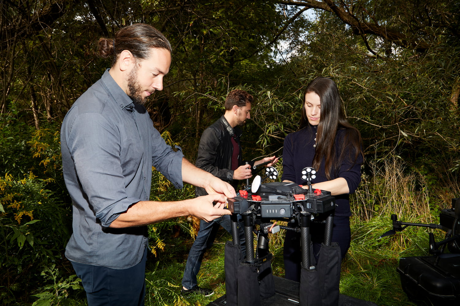
Freelance drone pilots download the Spexi app onto their mobile phone, complete a profile, and start taking on assignments. Pilots use their own microdrones (that weigh less than 250g) to create ultra high resolution standardized imagery datasets that customers can purchase. Spexi’s software takes over the drone’s flight controller—essentially the brain of the drone—to maintain its orientation and execute flight commands, while autonomously capturing imagery of targeted areas. These targeted areas are partitioned as three-dimensional hexagon-shaped grids, each containing flight path information that drones use to guarantee they’re flying at the right height, speed and location to gather all the necessary imagery.
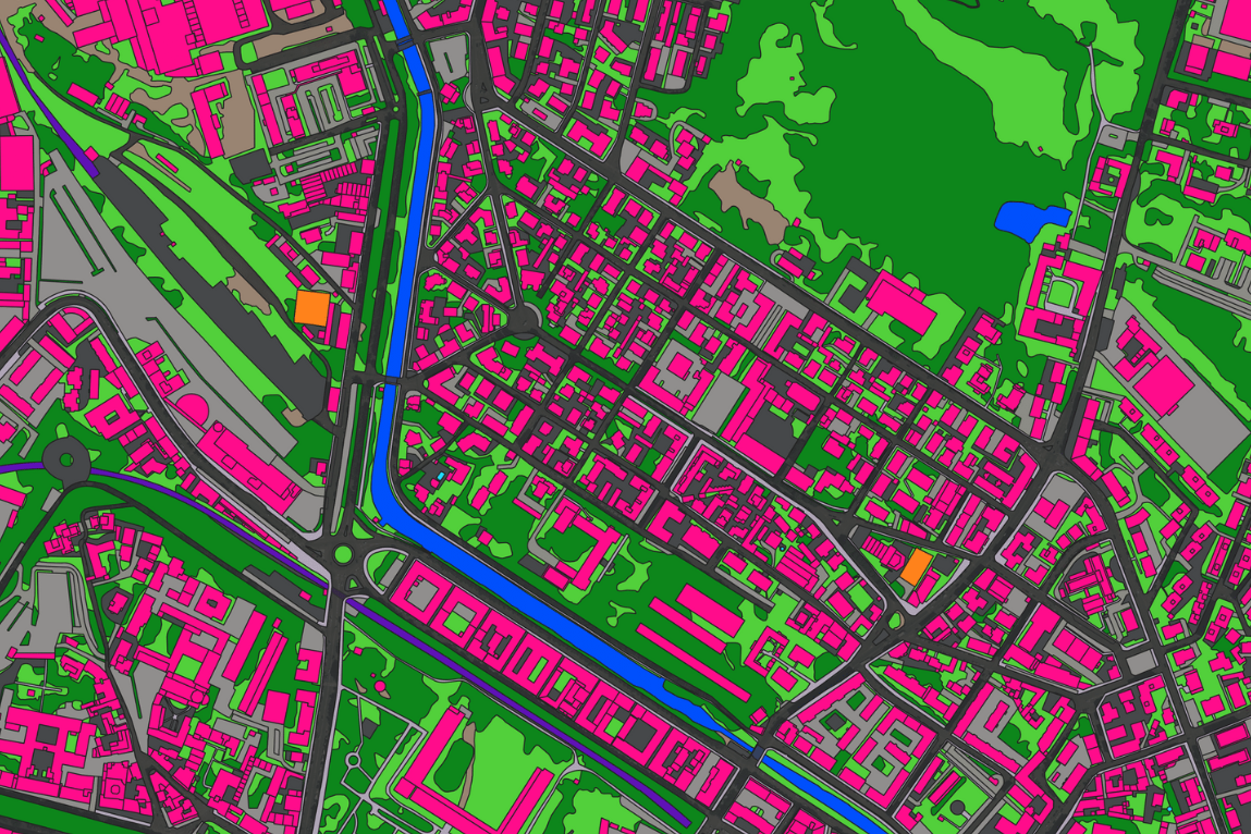
Many of our customers are municipalities like the cities of Vancouver, Kelowna, Austin, and Los Angeles. They use our data to make smarter decisions on how to manage their city. For example, cities are constantly making decisions about permits for buildings, events, business operations and any activities that might impact the environment. Our clients no longer have to drive to a site to determine where a laneway house might be located, or vegetation might exist. The Canadian government has a seven figure contract with us for emergency response and preparedness around wildfires: our data helps them understand how property might burn in the event of a fire because the imagery logs tree species, how dry the environment is, and distances between the natural environment and buildings.
Today, drones using Spexi’s software are flying over the world’s largest cities, but most people thought our dreams for the company were impossible—they said people would complain, it’d be too risky and it wouldn’t be feasible under current regulations. But, we had the vision, drive and knowledge to make it all work.
Related: Flash Forest Is in a Race to Scale up Its Business and Save the Planet
Now we’re building towards the next version of AI—where Spexi’s standardized drone imagery forms the foundational training layer for AI models, so they can become spatially aware of the physical world. Once AI becomes spatially aware, it can make better decisions on how physical objects, such as cars, scooters, bikes, and drones, navigate the real world. There’s also a use case with gaming, and directions on your phone. But for these models to exist, they need to be fed more frequently updated standardized imagery. We’re working to accomplish that with some of the biggest geospatial modelling companies and AR/VR gaming companies around.
It’s been an incredible ride—and we’re just getting started. We’ve raised a total of $23.5 million from investors in Canada and the United States, completing our Series A funding round in December 2024. We’re on track to become the world’s next major geospatial company. Along the way, I’ve learned that the most important factor in building a startup isn’t the product or the market—it’s the people. The team you surround yourself with is everything. We’ve leaned on each other, pushed through challenges together, and built a deep trust that drives us to do what’s best for the company.
—As told to Leah Golob